


COMPASS-GLM: Coastal Observations, Mechanisms, and Predictions Across Systems and Scales (COMPASS) Great Lakes Modeling (GLM)
The COMPASS-GLM project aims to enhance our understanding of coastal areas by studying both natural environments and human influences in great detail. Focusing on the Great Lakes Region, the project examines how local
ecosystems
and human activities affect each other and how they both respond to
climate change.
The insights and tools developed from this project can also be applied to other coastal regions to better understand and manage the impacts of climate systems and human actions on these areas.
| Keywords | coastal modeling, Great Lakes Region, high-resolution watershed modeling, regional modeling |
|---|---|
| TYPE | Project |
Principal Investigator (PI)
Rob Hetland
Lead Institution
Other Collaborators
Baylor University
Heidelberg University
Michigan Technical University
Pennsylvania State University
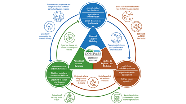
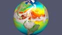
COMPASS-GLM Phase II theme triangle. (Image credit: COMPASS-GLM Project Team)
Categories
Other research you might be interested in
 COMPASS-FME: Coastal Observations, Mechanisms, and Predictions Across Systems and Scales (COMPASS) Field, Measurements, and Experiments (FME) Pilot Study
 ICoM: Integrated Coastal Modeling
 Probing Water Cycle Processes and Extremes in Coastal and Urban Environments Using Water Isotope Ratio Tracers and Numerical Tags