

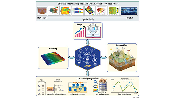
 AI4ESP: Artificial Intelligence for Earth System Predictability
 AmeriFlux Management Project
 ARM Data Center
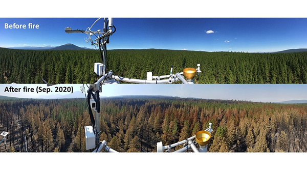
 ARM Instrument Experts
 ARM Translator Group
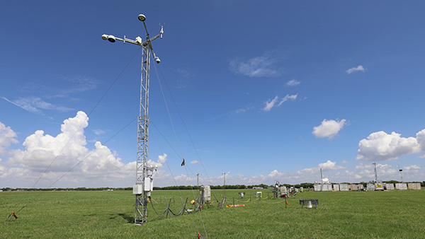
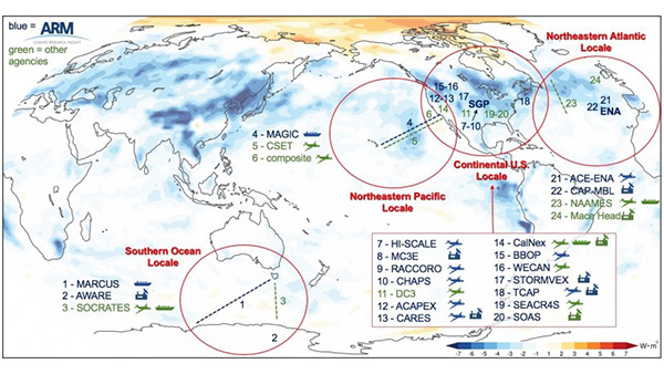
 Atmospheric Radiation Measurement (ARM) User Facility
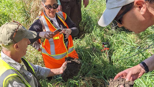
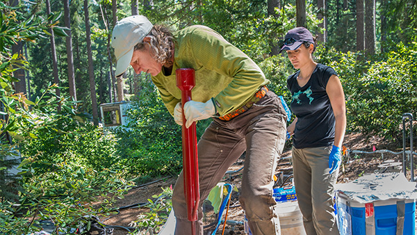 Belowground Biogeochemistry
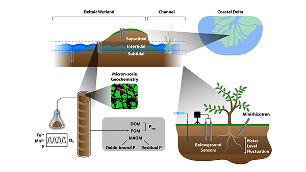 Biogeochemical Controls on Phosphorus in Urban-Influenced Coastal Ecosystems
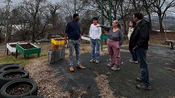 Biogeochemical Cycling at the Urban Interface
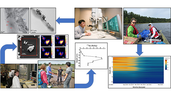 BioGeoChemistry at Interfaces
 CASCADE: Calibrated and Systematic Characterization, Attribution, and Detection of Extremes
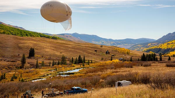
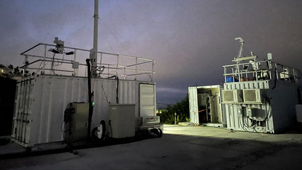
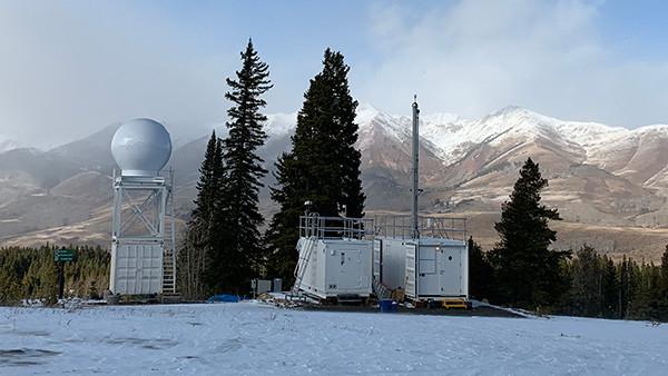 Characterization of the Aerobiome during the SAIL Campaign
 Cloud Processing of Carbonaceous and Supermicron Aerosol
 COMPASS-FME: Coastal Observations, Mechanisms, and Predictions Across Systems and Scales (COMPASS) Field, Measurements, and Experiments (FME) Pilot Study
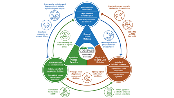 COMPASS-GLM: Coastal Observations, Mechanisms, and Predictions Across Systems and Scales (COMPASS) Great Lakes Modeling (GLM)
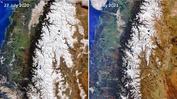
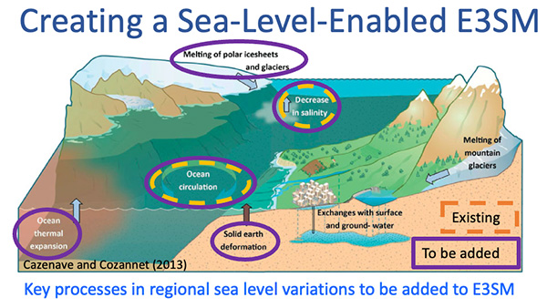 Creating a Sea-Level-Enabled E3SM
 CROCUS: Community Research on Climate and Urban Science
 E3SM: Energy Exascale Earth System Model
 EAGLES: Enabling Aerosol-cloud interactions at GLobal convection-permitting scalES
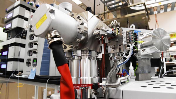 EMSL: Environmental Molecular Sciences Laboratory